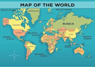
Activity 15 l The World Map and The Tectonic Plates

THE WORLD MAP AND TECTONIC PLATES PHOEBE MARIE BOHOL 10-DILIGENCE Maps of the world usually concentrate on either political or physical elements. Territorial boundaries and human settlement are highlighted on political maps. Mountain ranges, soil types, and land use are all depicted on physical maps. Not just the surface, but also the underlying rock, fault lines, and subterranean formations are depicted on geological maps. Color hue and intensity are used in choropleth maps to contrast disparities across regions, such as demographic or economic data. The many projections of the planet represent a variety of technical and aesthetic objectives for globe maps. World maps are also unique in that they require worldwide knowledge to create. Before the European Renaissance, no useful map of the world could be made because no culture knew more than half of the planet's coastlines, let alone its interior areas. Since then, new information about the earth's surface has b...
